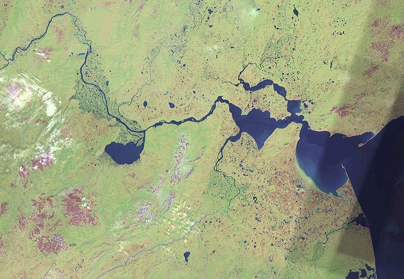
Датотека:Lower Anadyr.jpg

Величина овог приказа: 800 × 552 пиксела. 3 друге резолуције: 320 × 221 пиксела | 640 × 442 пиксела | 981 × 677 пиксела.
Оригинална датотека (981 × 677 пиксела, величина датотеке: 131 kB, MIME тип: image/jpeg)
Историја датотеке
Кликните на датум/време да бисте видели тадашњу верзију датотеке.
| Датум/време | Минијатура | Димензије | Корисник | Коментар | |
|---|---|---|---|---|---|
| тренутна | 23:33, 10. мај 2006. |  | 981 × 677 (131 kB) | Hardscarf | Surroundings of Anadyr, Chukotka, Russian Far East, Russia: To the left the Anadyr River, which flows over the Lowland of anadyr towards the Gulf of Onemen and further into the Anadyrski Estuarium to end in the Gulf of Anadyr on the ri |
Употреба датотеке
Следећа страница користи ову датотеку:
Глобална употреба датотеке
Други викији који користе ову датотеку:
- Употреба на af.wiki.x.io
- Употреба на az.wiki.x.io
- Употреба на bg.wiki.x.io
- Употреба на br.wiki.x.io
- Употреба на ca.wiki.x.io
- Употреба на ceb.wiki.x.io
- Употреба на cs.wiki.x.io
- Употреба на de.wiki.x.io
- Употреба на de.wiktionary.org
- Употреба на en.wiki.x.io
- Употреба на es.wiki.x.io
- Употреба на fi.wiki.x.io
- Употреба на fr.wiki.x.io
- Употреба на he.wiki.x.io
- Употреба на hr.wiki.x.io
- Употреба на hu.wiki.x.io
- Употреба на incubator.wikimedia.org
- Употреба на it.wiki.x.io
- Употреба на ja.wiki.x.io
- Употреба на ky.wiki.x.io
- Употреба на la.wiki.x.io
- Употреба на lt.wiki.x.io
- Употреба на lv.wiki.x.io
- Употреба на mn.wiki.x.io
- Употреба на nl.wiki.x.io
- Употреба на no.wiki.x.io
- Употреба на pl.wiki.x.io
- Употреба на pt.wiki.x.io
- Употреба на ru.wiki.x.io
- Употреба на sh.wiki.x.io
- Употреба на sl.wiki.x.io
- Употреба на tg.wiki.x.io
- Употреба на uk.wiki.x.io
Још глобалног коришћења ове датотеке.
